Introduction
The Sar Pass is a great hike for beginners.
The Sar Pass trek starts from Kasol and on the way, you will reach a small frozen lake and its name has itself named this pass. The total hiking distance is 48 km. At nearly 14,000 feet above sea level, the view from the pass is of the majestic mountains of the Parvati Valley. Here is everything you need to know about Sar pass Trek.
Location
The Sar Pass is located at an altitude of approximately 13,580 feet above sea level in the Kullu district of Himachal Pradesh.
Best time to visit
The climb and descent from Sar Pass are of moderate difficulty. The best time to travel on these trails is from May to October. Clear skies in May and June create a fantastic picturesque panorama of paths and meadows. Temperatures typically range between 13 and 17 degrees Celsius during the day and get colder at night.
Highlights
°Scenic trails along a changing scene of the turbulent Parvati River, gushing waterfalls, endless forests, and verdant meadows.
°Visit India’s Mini Israel, Grahan Village, a beautiful little hidden gem with 200 years of history in the Parvati Valley.
°Experience walking on a carpet of freshly glistening snow while enjoying breathtaking views of the Parvati Valley.
°Enjoy the exotic tastes of Himachali cuisine.
Itinerary
The hike begins in a dense forest and transitions into a complete whiteout. the trek to Grahan village and cross the Grahanhi Nalaar, following a rocky and rugged trail. It changes from a lush forest to a less green and white environment and walks uphill on the snow. During the trek, you will pass through various small meadows locally called thatch. It passes through Min-Thatch and Biscelli-Thatch and is mainly used by villagers to graze livestock
Day 1
Arrival at Kasol and 8kms trek to Grahan (7700 ft).
The route from Kasol to Grahan is a marked trail through the forest and following Grahan Nalah.
These are makeshift stalls with vendors selling snacks such as tea, omelets, and rhododendron syrup.
Day 2
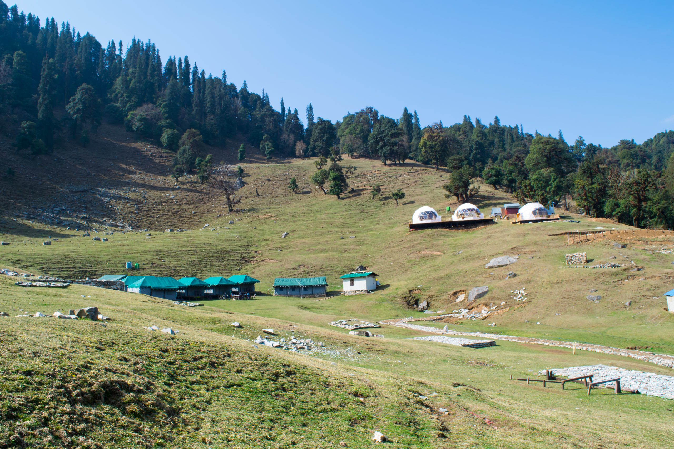
7Kms Trek from Grahan to Min Thach (1150 ft)
From the Grahan campground, the road heads north and climbs gently.
After walking for a while, the view opens up and a guide can point you to Min Thach, Nagaru, and Sar Top on the mountain to the right.
After a while, you will enter a dense forest. The dense canopy allows very little sunlight to enter. The slope becomes steeper and the road becomes difficult to find in places. After several hours of work, the forest opens up into a grassy patch on the ridge. This is Min Thach.
Day 3
8 km trek from Min Thach to Nagaru
After a few hours of trekking through this path, we finally arrive at the pleasant flatland on top of the hill, which is the Nagagaru Campsite. It’s like another world! The Min Thach campground and the village of Grahan can be seen on the lower left.
Day 4
Nagaru to sar pass and Biskeri Thach
The ascent to Sar Pass follows the ridge line southwards and becomes steeper in places.
When you reach the top of what looks like a long climb, you breathe a sigh of relief and joy as you take in the views ahead and it is sar pass.
Day 5
Trek from Biskeri Thach to Barschini and back to Kasol.