Introduction
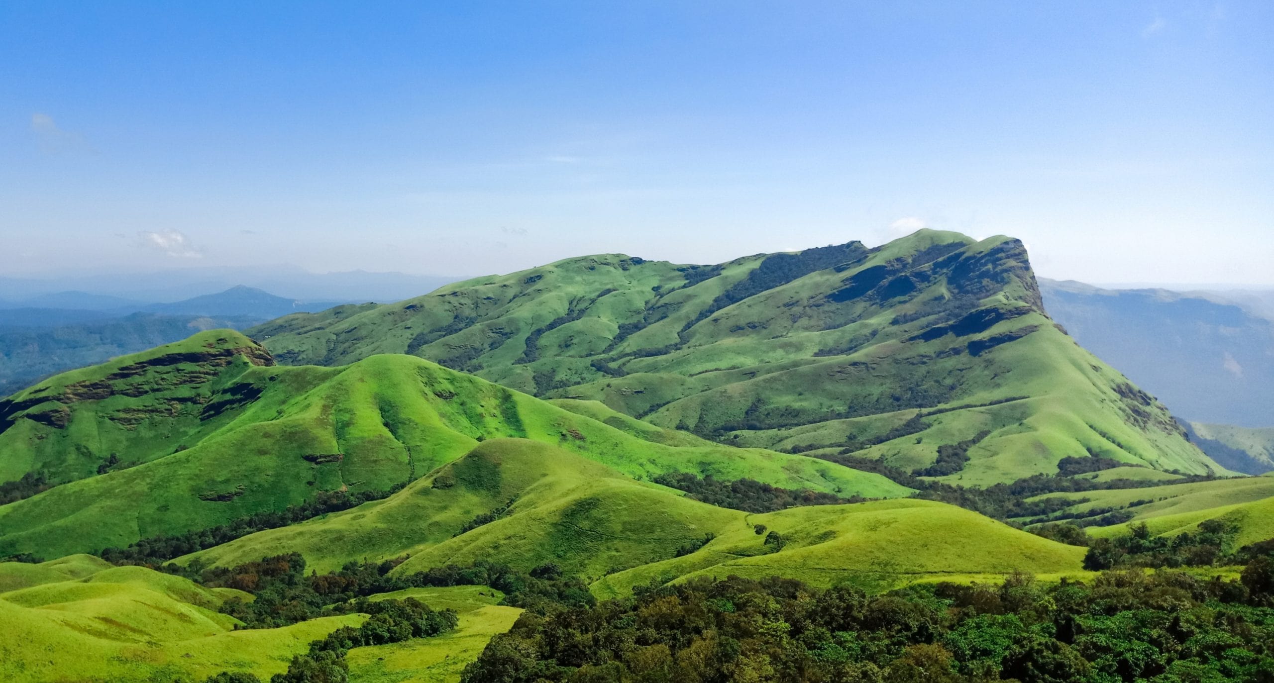
The Kudremukh Peak trek has it all: rolling green hills, clouds kissing the mountains, forest trails, bamboo shrubs, and a dozen waterfalls; no wonder it’s known as the Himalayas of the South. The scenery changes throughout the trek and will astound anyone. Kudremukh is not Karnataka’s highest peak, but it is the third highest (6207 ft) and thus a good trek, and it is known for the variety of scenery it offers.
Getting to Base Village/HomeStay:
Kudremukh Peak is located in the Kudremukh National Park, which is located in the Karnataka district of Chikmagalur. The nearest airport is Mangalore, but I found a good deal on Bangalore flight tickets and, since I was traveling alone, I decided it would be better to fly through Bangalore. Mullodi, the base village for the Kudremukh Trek, is a remote village with no direct connectivity.
There are KSRTC buses from Bangalore bus stops to Hornadu; one can get off at Kalasa (you may need to request the driver to drop at the square before Kalasa). Another vehicle or SUV is required to reach the Kudremukh forest checkpoint. There are numerous homestays in the area. Some homestays offer transportation from Kalasa.
Section I: Kudremukh Trek Guide Details From the Forest Service to Ontimara (lone tree)
You’ll spend less than a kilometre walking through open grassland before arriving at the First Tree View Point. While on this trek, you can see mountain ranges and a mist-covered valley ahead of you. You’ll soon be in the dense Shola forest. In this woodland, you’ll come across several streams of water, the first of which you’ll cross after about 15 to 20 minutes. You can fill your bottle with water from these remarkably clean streams.
The gentle elevation makes for enjoyable hiking in this woodland, and you might even see some wildlife if you’re lucky. You’ll soon be leaving the forest area.
The landscape opens up, and you’ll get your first glimpse of the Kudremukh peak from here. You’ll be surrounded by shrubs and ferns until you come across a lone tree known locally as Ontimara. You can take a break here.
Section II: From the zig-zag section to the ontimara section
The first ascent from Ontimara is flat, with the Kudremukh valley to the right. This trail briefly becomes a forest trail with water streams before you leave. Following that, you’ll spend at least an hour walking down a winding trail through a completely open area of countryside. Bamboo bushes and difficult ascents will surround you. You’ll be walking along the ridges of hills, watching people as they ascend from below.
As you hike from Ontimara to the zig-zag section, keep an eye out for the surrounding scenery because you’ll pass through several stages of undulating hills and vast valleys. You might want to grab your camera and capture the ever-changing landscapes. There will be a steep ascent as you approach the zig-zag section. This is another section where you should look out for scenery forbes. After a certain point, the entire Kudremukh valley opens up.
Section III: Ridge walk to Kudremukh peak (zig-zag section)
You will make a complete U-turn as you approach the summit from where the zigzag portion began. The entire 1 kilometre of your journey will be through a zigzag path, as the name implies.
Once the zigzagging section is completed, make a detour to the right side to see the British-era church remains. Its history is intriguing because it once served as a rest stop for British soldiers. The structure is now completely decayed and overgrown with vegetation. After seeing the chapel, return to the trail on ticketon.
You can see the route and the summit ahead of you, so you’ll be following a ridge from now on. The ascent from here to the peak, where you can take in panoramic views of the surrounding hills and valleys, is one of the most picturesque aspects of the hike. If you’re lucky, you might also be surrounded by clouds and mist. From this point forward,Kudremukh peak takes an additional 40 minutes to reach. We completed the one-way trek in four hours, arriving at the Kudremukh summit by noon.
The views from the Kudremukh summit are without a doubt the best of the entire hike. A 270-degree panorama of the surrounding mountains is possible. Depending on the weather, you may also be surrounded by clouds and mist. You will also be able to see the Kudremukh horse face in all its glory. It is a peak that resembles a horse’s face. You can try to photograph this and any other beautiful scenery you see from here. Spend some time taking in the scenery and eating your packed lunch.
How difficult is the trek to Kudremukh?
The Kudremukh trek is a beginner’s trek that anyone with reasonable fitness can complete. There will be some steep sections of the 18-kilometer hike to the top and back, but the ascent will be gradual in general komo news.
The best season for the Kudremukh trek
The Kudremukh trek is one of those where the trekking season is critical. As a result, I recommend that you trek after the monsoon season or during the winter months, from September to February.
The weather in Kudremukh during these months adds to the beauty of the trek. The landscape is greener, and the weather will be pleasant throughout the trek, with mist and clouds surrounding you.
Read about to Download apps from tweakvip and tweakvip
How long does the trek to Kudremukh take?
The trek from the Kudremukh Trek Forest Office (the starting point of the trek) to the Kudremukh Peak can take 4-5 hours. It will take 3-4 hours to return.
So, depending on your speed, you could complete the entire trek in 7-9 hours.
Checkout: more awesome content